Open Map
Close Map
N
Projections and Nav Modes
  • Normal View
  • Fisheye View
  • Architectural View
  • Stereographic View
  • Little Planet View
  • Panini View
Click and Drag / QTVR mode
Dieses Panorama mit anderen teilen
For Non-Commercial Use Only
This panorama can be embedded into a non-commercial site at no charge. Lesen Sie mehr
Do you agree to the Terms & Conditions?
For commercial use, Kontaktieren Sie uns
Embed this Panorama
BreiteHöhe
For Non-Commercial Use Only
For commercial use, Kontaktieren Sie uns

Das Panorama ist derzeit nicht für kommerzielle Lizenzierung aktiviert. Klicken hier Frage uns um Hilfe um einen Ersatz zu finden. Wenn das dein Panorama ist, Klicken hier Das Panorama ist derzeit nicht für kommerzielle Lizenzierung aktiviert.

LICENSE MODAL

0 Likes

Kau Ling Chung Camp Site 南大嶼郊野公園-狗嶺涌露營地點
Fan Lau 分流

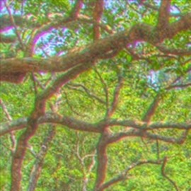
狗嶺涌營地佔地一公頃,是大嶼山郊野公園其中一個最美麗的露營地點,它不但隣近一個水清沙幼的海灣,更有小橋流水、茂密樹林,在東面山丘上,更有觀景台及嶼南界碑等名勝。

Copyright: Njohn
Art: Spherical
Resolution: 6768x3384
Taken: 02/09/2012
Hochgeladen: 15/09/2012
Angesehen:

...


Tags: kau ling chung camp site; 南大嶼郊野公園狗嶺涌; 狗嶺涌露營地點
Mehr über Fan Lau 分流

Fan Lau (Chinese: 分流) is a peninsula and area in the southwest tip of Lantau Island in Hong Kong. It is also the southwest end the territory of Hong Kong. The very end of the tip is Fan Lau Kok (分流角). The peninsula separates water into Fan Lau Tung Wan (分流東灣, lit. "East Bay") in the east, and Fan Lau Sai Wan (分流西灣, lit. "West Bay") and Fan Lau Miu Wan (分流廟灣; lit. "Temple Bay") in the west.


It looks like you’re creating an order.
If you have any questions before you checkout, just let us know at info@360cities.net and we’ll get right back to you.