Open Map
Close Map
N
Projections and Nav Modes
  • Normal View
  • Fisheye View
  • Architectural View
  • Stereographic View
  • Little Planet View
  • Panini View
Click and Drag / QTVR mode
Share this panorama
For Non-Commercial Use Only
This panorama can be embedded into a non-commercial site at no charge. Read more
Do you agree to the Terms & Conditions?
For commercial use, contact us
Embed this Panorama
WidthHeight
For Non-Commercial Use Only
For commercial use, contact us
LICENSE MODAL

1 Like

Crossing Langglupbekken
Norway

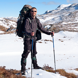
The Langglupbekken stream runs between two of the highest mountains in the Rondane, Rondslottet (2178) and Høgronden (2110m). You'll cross Langglupbekken by following the DNT route from Bjørnhollia to Dørålseter.

The Rondane is the oldest national park in Norway, established on 21 December 1962. The park contains ten peaks above 2,000 metres (6,560 ft), with the highest being Rondeslottet at an altitude of 2,178 m (7,146 ft). The park is an important habitat for herds of wild reindeer.

The park was extended in 2003, and now covers an area of 963 km2 (372 sq mi) in the counties Oppland and Hedmark.

From Wikipedia, the free encyclopedia

Copyright: Ronald Tichelaar
Type: Spherical
Resolution: 8452x4226
Taken: 14/09/2009
Uploaded: 26/05/2015
Views:

...


Tags: outdoors; nature; fall; autumn; hiking; stream; waterfall
More About Norway


It looks like you’re creating an order.
If you have any questions before you checkout, just let us know at info@360cities.net and we’ll get right back to you.