Vista Peak
Share
mail
License license
loading...
Loading ...

Panoramic photo by Scott Harper PRO EXPERT Taken 17:31, 10/09/2011 - Views loading...

Vista Peak

The World > North America > USA > Alaska

  • Like / unlike
  • thumbs up
  • thumbs down

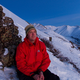
This pano is taken from the top of Vista Peak. It is about 4.5 miles from the Baldy Trailhead in Eagle River, Alaska past Blacktail and Ptarmigan Rocks. This was a great fall hike near the end of September 2011. We even hit a little wet, short-lived snow before reaching Vista. Very dark and overcast day and I feel the photos reflect the mood well. We rushed down the mountain and barely made it to Shine's for some sushi and sake to cap the day off.

comments powered by Disqus

Nearby images in Alaska

map

A: Just South of Vista Peak 2011/09/10

by Scott Harper, 160 meters away

This photo was taken near the top of Vista Peak just to the south. It was a beautiful early fall day ...

Just South of Vista Peak 2011/09/10

B: Near Vista Peak 2011 09 10

by Scott Harper, 1.0 km away

This photo was taken on an early fall day in the Chugach on the way to Vista Peak from Baldy Trailhea...

Near Vista Peak 2011 09 10

C: Behind the Blacktail Rocks

by Scott Harper, 1.8 km away

This photo was taken in early fall of 2011 on the way to Vista Peak. There are decent views of Anchor...

Behind the Blacktail Rocks

D: Mount Magnificent in the Clouds

by Scott Harper, 2.3 km away

Not the most exciting pano, but it was all I could do this day. Clouds lifted about an hour after we ...

Mount Magnificent in the Clouds

E: Blacktail Rocks

by Scott Harper, 2.5 km away

Here is a photo taken from the top of Blacktail and Ptarmigan Rocks. The opening view shows Cook Inle...

Blacktail Rocks

F: Below the last false peak before Magnificent

by Scott Harper, 2.7 km away

Coming down off of Magnificent the fog started to lift. I started taking more photos on the way down ...

Below the last false peak before Magnificent

G: Between Tucker and the false peak before Magnificent

by Scott Harper, 3.1 km away

Another shot from one of the false peaks on the way to Mount Magnificent. Each peak has their own uni...

Between Tucker and the false peak before Magnificent

H: Between Mile High Saddle and Tucker Mountain

by Scott Harper, 3.3 km away

It is a long three mile hike to Magnificent. Notice all of the false peaks along the ridge. There is ...

Between Mile High Saddle and Tucker Mountain

I: Above and to the east of Mile High Saddle

by Scott Harper, 4.2 km away

On the way to Mount Magnificent from Mile Hi Trailhead. I took this pano just before entering the clo...

Above and to the east of Mile High Saddle

J: Mile High Saddle

by Scott Harper, 4.5 km away

This photo is a little deceiving, this is not a steep place at this photo, but this comes out looking...

Mile High Saddle

This panorama was taken in Alaska

This is an overview of Alaska

Alaska is the largest state in the United States by area. It is situated in the northwest extremity of the North American continent, with Canada to the east, the Arctic Ocean to the north, and the Pacific Ocean to the west and south, with Russia further west across the Bering Strait. Approximately half of Alaska's 710,231 residents (as per the 2010 United States Census) live within the Anchorage metropolitan area. Alaska is the least densely populated state of the U.S.

Source: http://en.wikipedia.org/wiki/Alaska

Share this panorama