White Rim Road's Gooseneck Viewpoint
シェア
mail
License license
loading...
Loading ...

パノラマを撮影したのは Thomas Stano EXPERT 撮影日 23:06, 11/09/2005 - Views loading...

White Rim Road's Gooseneck Viewpoint

The World > North America > USA > Utah

  • いいね! / ダメ
  • thumbs up
  • thumbs down

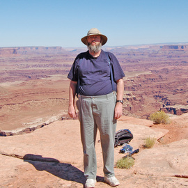
At this stop on the White Rim Road you can see the Goose Neck, a S-curve in the Colorado River. From here you can also see Dead Horse Point and the Walking Rocks

comments powered by Disqus

Utah付近のパノラマ

map

A: The Goose Neck

Thomas Stano作, 2.6kmかなた

I found this spot along Shafer canyon road on my way back to moab. If you look at this from Dead Hors...

The Goose Neck

B: Dead Horse Point Observation Platform

Thomas Stano作, 4.1kmかなた

Dead Horse Point State Park  Obsevation Platform Provides dramaticin the United States, featuring a d...

Dead Horse Point Observation Platform

C: White Rim Road's Lathrop Canyon road Junction

Thomas Stano作, 4.7kmかなた

Here you see the head of Lathrop Canyon. The road you see runs four miles to a Picnic area on the ban...

White Rim Road's Lathrop Canyon road Junction

D: White Rim Road's Shafer Canyon Overlook

Thomas Stano作, 5.0kmかなた

The White Rim Road is a 100 mile dirt road (High Clearance and or Four wheel drive vechiles only plea...

White Rim Road's Shafer Canyon Overlook

E: The Neck Viewpoint

Thomas Stano作, 5.1kmかなた

The Neck is a narrow strip of land seprating Taylor Canyon to the west and Shafer Canyon to the east ...

The Neck Viewpoint

F: White Rim Road's Airport Tower Camp Site

Thomas Stano作, 6.4kmかなた

This is Airport Camp Site located at the base of Airport Tower about nineteen miles from the visitor ...

White Rim Road's Airport Tower Camp Site

G: The Washer Woman Arch and Monster Tower

Thomas Stano作, 7.8kmかなた

From this point on the White Rim Road in Canyonlands National Pyou get a good view of Washer Woman Ar...

The Washer Woman Arch and Monster Tower

H: Mesa Arch Canyonlands at Sunrise

Neil Parris作, 10.3kmかなた

The Famous Mesa Arch is possibly THE best place to be for a sunrise photo in Canyonlands National Par...

Mesa Arch Canyonlands at Sunrise

I: The Mesa Arch

Thomas Stano作, 10.4kmかなた

Mesa Arch is an easy to visit landmark in the Island in the Sky region of Canyonlands national park. ...

The Mesa Arch

J: The Mesa Arch and the Washer Woman Arch

Thomas Stano作, 10.4kmかなた

From this spot you get how a scenic view of the mesa arch, washerwoman arch, monster tower and buck c...

The Mesa Arch and the Washer Woman Arch

このパノラマはUtahで撮影されました

これはUtah領域の概要です

Utah is a state located in the westcentral region of the United States of America.  Utah is the 13th largest state by area, ranks 34th by population and 10th by population density of the 50 United States.  Utah was the 45th state to be admitted into the Union, on January 4, 1896. Utah is landlocked, being bordered by the states of Idaho to the north, Wyoming to the northeast, Nevada on the west, Colorado on the east and Arizona to the south.  Utah is very mountainous and is a popular outing destination of the outdoorsman.  The state population is about 2.82M with 95% being Caucasian, 2.4% Asian, 1.7% Native American and 1.3% Black. The state capital and largest city is Salt Lake City.

Source: wikipedia

このパノラマをシェアする