Umschalten der Navigation
Search
Search
Einloggen / Neu anmelden
Einloggen
New Account / View Pricing
Erkunden
360° Video Gallery
Weltkarte
Redaktionelle Auswahl
Gigapixel
360° Stereoscopic Panoramas
Learn
CONTRIBUTE
LICENSE
EARN $ FROM YOUR WORK
FREE RESEARCH
Erkunden
360° Video Gallery
Gigapixel Gallery
Curated Sets
Weltkarte
360° Stereoscopic
Panorama-Auswahl
More
Learn
CONTRIBUTE
LICENSE
EARN $ FROM YOUR WORK
FREE RESEARCH
Neu anmelden/Einloggen
Einloggen
Get a new Contributor Account
Erstelle ein neues lizenziertes Kundenkonto
Newsletter
×
Lightboxes
Copy
Create New Lightbox
This Lightbox is empty
×
Saved!
Search Results for @author pix
Keywords
Location
Contributor
Show only licensable content
Show live previews
Search
Keyword Tip: Use quotation marks ("Golden Gate Bridge") to search for an exact phrase.
More tips
.
Panoramen (465)
Videos (2)
Contributors (1)
William L
Hemingway Memorial
20756 x 10378
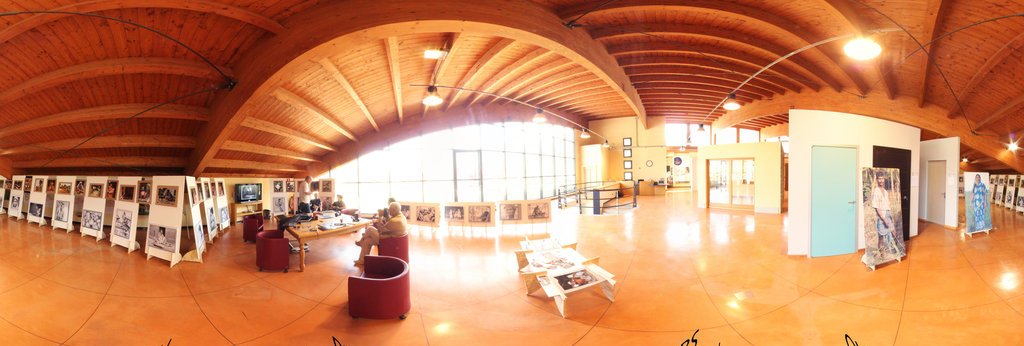
Luciano Correa | Vista Panoramica
Youpix Festival Pessoas + Pixel no Ibirapuera em São Paulo
16000 x 8000
Joby Catto
Sylvia Plath’s grave at Heptonstall, near Hebden Bridge
6432 x 3216
William L
Ernest Hemingway grave - Ketchum Cemetery
20756 x 10378
William L
Aspen foliage
13200 x 6600
John Gore
Alan Paton's Study in Pietermaritzburg
14264 x 7132
Dashkov Vladimir
N.Ostrovskomu's monument
11748 x 5874
Miroslav Olesnanik
Lomnický štít 2 a autor
9808 x 4904
Piotr Rymer
Pope John Paul II sculpture, autor Jacek Osadczuk
8000 x 4000
Randy Kasal
Mihail Sadoveanu Museum / Muzeul Mihail Sadoveanu. Iasi, Romania.
30000 x 15000
James Womack
Gravesite of "Gone with the Wind" Author Margaret Mitchell, Oakland Cemetary
4000 x 2000
Francesco Favalesi
Mostra fotografica VILLAGGI TRIBALI del Bangladesh - Autore Oliviero MASSEROLI
13058 x 6529
Francesco Favalesi
Mostra fotografica I VILLAGGI TRIBALI del Bangladesh - Autore Oliviero MASSEROLI
13094 x 6547
M.J.Lorek
Stevns Fyr Gallery
10760 x 5380
M.J.Lorek
H.C.Andersens House, Odense
13016 x 6508
Pete Babij
2017.07.01 Lincoln and the Common Man Statues
29900 x 14950
M.J.Lorek
Kamienna Gora , Winter view
13064 x 6532
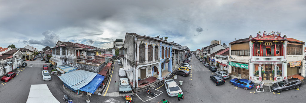
Actsugi
Lee Sih Chong Soo
11008 x 5504
Augusto Ilian
Downtown Cali, Valle del Cauca, Colombia. San Francisco Place
8192 x 4096
Augusto Ilian
Teatro Municipal Enrique Buenaventura, Cali. Municipal Theatre Enrique Buenaventura
8192 x 4096
Augusto Ilian
El Peñon Park and Sagrada Familia School, Cali, Valle del Cauca, Colombia
8192 x 4096
Augusto Ilian
Downtown Cali, Valle del Cauca. Colombia. Near Hotel Aristi
8192 x 4096
Roy Reed
The Chancel, St Wyllow’s Church, Lanteglos-by-Fowey
17082 x 8541
Roy Reed
The Nave, St Wyllow’s Church, Lanteglos-by-Fowey
17080 x 8540
← Previous
-
1
-
2
-
3
-
4
-
5
-
6
-
7
-
8
-
9
-
…
-
18
-
19
-
Next →
Cookies help us deliver great service to you. By using this site, you agree to the use of cookies.
OK
Leave this Site