Open Map
Close Map
N
Projektioner och Nav lägen
  • Normal View
  • Fisheye View
  • Architectural View
  • Stereographic View
  • Little Planet View
  • Panini View
Click and Drag / QTVR mode
Dela detta panorama
För icke-kommersiellt bruk
Detta panorama kan bäddas in på en icke-kommersiell webbplats utan kostnad. Läs mera
Vill du gå med på Terms & Conditions?
För kommersiellt bruk, kontakta oss
Bädda in detta panorama
BreddHöjd
För icke-kommersiellt bruk
För kommersiellt bruk, kontakta oss
LICENSIERA MODAL

0 Likes

Eldfell volcanic cone
Iceland

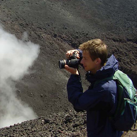
Eldfell is a volcanic cone just over 200 metres high on the island of Heimaey south of Iceland mainland. It formed in a volcanic eruption, which began without warning on the eastern side of Heimaey, in the Westman Islands, on 23 January 1973. The name means Hill of Fire in Icelandic.

The eruption caused a major crisis for the island and nearly led to its permanent evacuation. Volcanic ash fell over most of the island, destroying around 400 homes, and a lava flow threatened to close off the harbour as you can see in the view to the north.

Copyright: Jakub Hruska
Typ: Spherical
Upplösning: 13814x6907
Taken: 27/07/2018
Uppladdad: 16/08/2018
Visningar:

...


Tags: iceland; island; geology; volcano; lava; magma; ash; scoria; pumice; ocean; sea; mountain; path; rock; fire; harbour; nature; power
Mer om Iceland


It looks like you’re creating an order.
If you have any questions before you checkout, just let us know at info@360cities.net and we’ll get right back to you.