


0 Likes
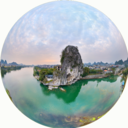
The tiny settlement Walkerville is approx. 190 kilometres south-east of Melbourne. Once a busy place due to its lime industry, Walkerville gets now very busy during summer months with visitors to the sandy beaches of Waratah Bay. Walkerville is surrounded by the Cape Liptrap Coastal Park and the peaks of Wilsons Promontory National Park can be seen on on the horizon.
...


Victoria is Australia's second smallest State and covers only 3% of Australia's land area but has the second highest population of all States and Territories. Victoria's mainland and islands have a total length of 2,512 kilometres coastline which is about 4.2% of Australia's 59,736 kilometres of coastline. Australia is the driest inhabited continent and Victoria is no exception although the state capital Melbourne has the reputation to have 4 seasons in one day. Victoria is located in the southeast of mainland Australia and includes the most southern point on mainland Australia at Wilsons Promontory National Park.

