Toggle navigation
Search
Sign In / Sign Up
Sign In
New Account / View Pricing
Explore
360° Video Gallery
World Map
Editors' Picks
Gigapixels
360° Stereoscopic Panoramas
Learn
CONTRIBUTE
LICENSE
EARN $ FROM YOUR WORK
FREE RESEARCH
Explore
360° Video Gallery
Gigapixel Gallery
Curated Sets
World Map
360° Stereoscopic
Editors' Picks
More
Learn
CONTRIBUTE
LICENSE
EARN $ FROM YOUR WORK
FREE RESEARCH
Sign up/Sign in
Sign in
Get a new Contributor Account
Get a new Licensing Customer Account
Newsletter
×
Lightboxes
Copy
Create New Lightbox
This Lightbox is empty
×
Saved!
Search Results for
@tags-paiute
Show only licensable content
Show live previews
Learn about advanced search options in our
Help Guide
.
Panoramas (30)
Videos (1)
Contributors (0)
Locations (0)
William L
Infernal Caverns Memorial Monument
20756 x 10378
William L
Battle of Infernal Caverns overlook
20756 x 10378
John Roberts
Pipe Spring National Monument, Arizona, USA
17268 x 8634
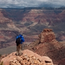
Allan Der
Sunset at Tuweep Overlook Grand Canyon National Park
26868 x 13434
Calvin Jones
Paiute ATV trail near Jacks Peak
11916 x 5958
Calvin Jones
Paiute ATV trail Broad Canyon
11724 x 5862
Calvin Jones
Paiute ATV trail, North Fork Chalk Creek canyon
11676 x 5838
Calvin Jones
Paiute ATV Trail - junction of 96 and 102
11704 x 5852
Calvin Jones
Paiute ATV - Lower Kimberly road camp
11044 x 5522
Calvin Jones
Paiute ATV - Dry Creek / Lost Canyon
10528 x 5264
Calvin Jones
Paiute ATV - Jacks Peak Marker
11936 x 5968
Calvin Jones
Paiute ATV - Jacks Peak, Pharo Creek canyon
14316 x 7158
Calvin Jones
Paiute ATV - Paradise Canyon Steam Sawmill
14032 x 7016
Calvin Jones
Paiute ATV - Pioneer Peak
7320 x 3660
Calvin Jones
Paiute ATV - Reese Canyon / Pioneer Peak trail head
11088 x 5544
Calvin Jones
Paiute ATV - Robins Lake
14044 x 7022
Calvin Jones
Piaute ATV - Aspen grove
11024 x 5512
Calvin Jones
Paiute ATV - White Pine Peak
10588 x 5294
Calvin Jones
Max Reid Trail, Paiute ATV trail, Utah
10580 x 5290
Calvin Jones
Paiute ATV - The Devils Armchair
11244 x 5622
Calvin Jones
Paiute ATV - Camping spot on FS 500
9948 x 4974
Calvin Jones
Paiute ATV - Silver King Mine
11888 x 5944
Calvin Jones
Paiute ATV - Silver King Mine 1
11704 x 5852
Calvin Jones
Paiute ATV - Winkler Point
18592 x 9296
← Previous
-
1
-
2
-
Next →
Cookies help us deliver great service to you. By using this site, you agree to the use of cookies.
OK
Leave this Site