Open Map
Close Map
N
Projections and Nav Modes
  • Normal View
  • Fisheye View
  • Architectural View
  • Stereographic View
  • Little Planet View
  • Panini View
Click and Drag / QTVR mode
Condividi questo panorama
For Non-Commercial Use Only
This panorama can be embedded into a non-commercial site at no charge. Leggi oltre
Do you agree to the Terms & Conditions?
For commercial use, Contattaci
Embed this Panorama
LarghezzaAltezza
For Non-Commercial Use Only
For commercial use, Contattaci
LICENSE MODAL

0 Likes

The Matterhorn, Switzerland
Gornergrat, Matterhorn, Zermatt

Rising to 4,478 metres above sea level, the Matterhorn is one of the most recognizable mountains in the world and a symbol of Switzerland. Straddling the border between Switzerland and Italy, its distinctive pyramidal shape has inspired mountaineers, artists, and travelers for generations. The first successful ascent in 1865 marked a defining moment in the history of Alpine exploration. Today, the mountain remains the centerpiece of the Zermatt region and one of the most celebrated landmarks in the European Alps.

Copyright: Andrew Bodrov
Type: Spherical
Resolution: 50000x25000
Taken: 11/06/2026
Caricate: 15/06/2026
Published: 15/06/2026
Numero di visualizzazioni:

...


Tags: matterhorn; zermatt; switzerland; alps; swiss alps; mountain peak; alpine landscape; mountaineering; hörnli ridge; pennine alps; iconic mountain; european alps; valais; aerial; airpano; skycam; drone
More About Gornergrat, Matterhorn, Zermatt

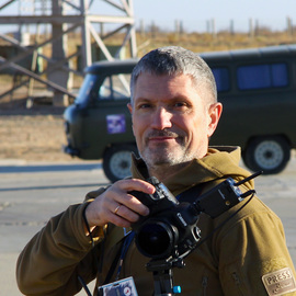
Eine tolle Tour über den Furgg und den oberen Theodulgletscher in Zermatt mit der anschliessenden Besteigung des Breithorns. Die Tour wurde durch den Anbieter hoehenfiber.ch organisiert. Die Organisation hat bestens geklappt. Auch die Unterkunft in der Gandegghütte mit dem tollen Essen bleibt in bester Erinnerung


It looks like you’re creating an order.
If you have any questions before you checkout, just let us know at [email protected] and we’ll get right back to you.