Umschalten der Navigation
Search
Search
Einloggen / Neu anmelden
Einloggen
New Account / View Pricing
Erkunden
360° Video Gallery
Weltkarte
Redaktionelle Auswahl
Gigapixel
360° Stereoscopic Panoramas
Learn
CONTRIBUTE
LICENSE
EARN $ FROM YOUR WORK
FREE RESEARCH
Erkunden
360° Video Gallery
Gigapixel Gallery
Curated Sets
Weltkarte
360° Stereoscopic
Panorama-Auswahl
More
Learn
CONTRIBUTE
LICENSE
EARN $ FROM YOUR WORK
FREE RESEARCH
Neu anmelden/Einloggen
Einloggen
Get a new Contributor Account
Erstelle ein neues lizenziertes Kundenkonto
Newsletter
×
Lightboxes
Copy
Create New Lightbox
This Lightbox is empty
×
Saved!
Search Results for @tags @tags aerial
Keywords
Location
Contributor
Show only licensable content
Show live previews
Search
Keyword Tip: Use quotation marks ("Golden Gate Bridge") to search for an exact phrase.
More tips
.
Panoramen (+10000)
Videos (1181)
Contributors (8)
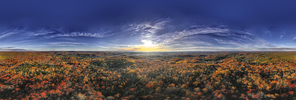
Robert Prior
Sunrise Over Autumn Woods V
25000 x 12500
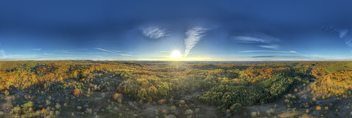
Robert Prior
Early Morning Over Autumn Woods I
25000 x 12500
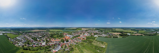
Jindrich Cermak
Borovany, Czech Republic
18294 x 9147
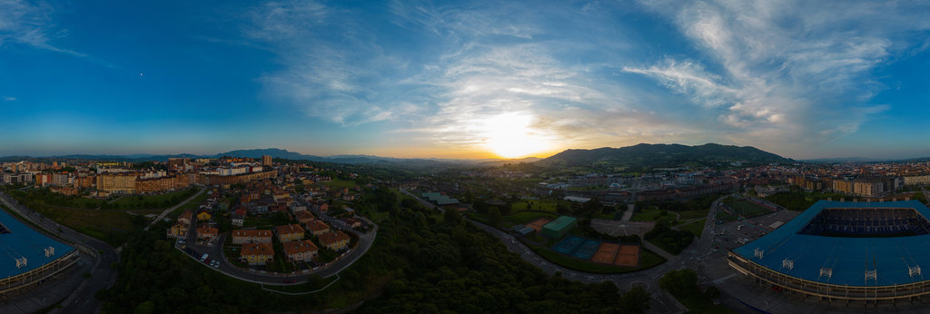
Jose Ignacio Teran
Aerial panorama of the Carlos Tartiere Stadium of the Real Oviedo football club 2 in Oviedo
12000 x 6000
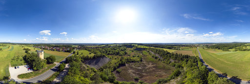
Jan Köhn
Tongrube Marloffstein
18926 x 9463
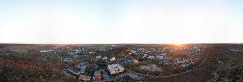
Zdeněk Fiedler
Milovice
35690 x 17845
Andrew Bodrov
Mars Panorama - Perseverance rover: Martian solar day 0454
30000 x 15000
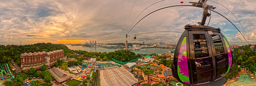
Gil Abadines
Suspended at Dusk, Sentosa Approach
14000 x 7000
[email protected]
Central Square Cardiff(Aerial Panorama)April 2016
9188 x 4594
William L
Bear Canyon basalt columns (aerial)
18800 x 9400
William L
Glass Mountain - Lyons Peak (aerial)
18800 x 9400
William L
Pine Creek Road (aerial)[1]
18800 x 9400
William L
Pine Creek Road (aerial)[2]
18800 x 9400
William L
Highway 97/A12 intersection (aerial)
18800 x 9400
William L
Pine Creek Pass Trailhead (aerial)
18800 x 9400
William L
South Lake Road aspens (aerial)
18800 x 9400
William L
Riverview (4543'/1385m) summit (aerial)
18800 x 9400
William L
Interstate 5 - Pollard Flat (aerial)
18800 x 9400
William L
Sherri Papini kidnapping hoax (aerial)
18800 x 9400
William L
Willapa Bay - Freshwater Creek (aerial)
18800 x 9400
William L
Rogue River - Robertson Bridge (aerial)
18800 x 9400
William L
Antelope Fire aftermath (aerial)[2]
18800 x 9400
William L
De Moss County Park (aerial)
18800 x 9400
William L
Highway 395/270 junction (aerial)
18800 x 9400
← Previous
-
1
-
2
-
…
-
72
-
73
-
74
-
75
-
76
-
77
-
78
-
79
-
80
-
…
-
416
-
417
-
Next →
Cookies help us deliver great service to you. By using this site, you agree to the use of cookies.
OK
Leave this Site