Umschalten der Navigation
Search
Search
Einloggen / Neu anmelden
Einloggen
New Account / View Pricing
Erkunden
360° Video Gallery
Weltkarte
Redaktionelle Auswahl
Gigapixel
360° Stereoscopic Panoramas
Learn
CONTRIBUTE
LICENSE
EARN $ FROM YOUR WORK
FREE RESEARCH
Erkunden
360° Video Gallery
Gigapixel Gallery
Curated Sets
Weltkarte
360° Stereoscopic
Panorama-Auswahl
More
Learn
CONTRIBUTE
LICENSE
EARN $ FROM YOUR WORK
FREE RESEARCH
Neu anmelden/Einloggen
Einloggen
Get a new Contributor Account
Erstelle ein neues lizenziertes Kundenkonto
Newsletter
×
Lightboxes
Copy
Create New Lightbox
This Lightbox is empty
×
Saved!
Search Results for @tags british
Keywords
Location
Contributor
Show only licensable content
Show live previews
Search
Keyword Tip: Use quotation marks ("Golden Gate Bridge") to search for an exact phrase.
More tips
.
Panoramen (3116)
Videos (104)
Contributors (0)
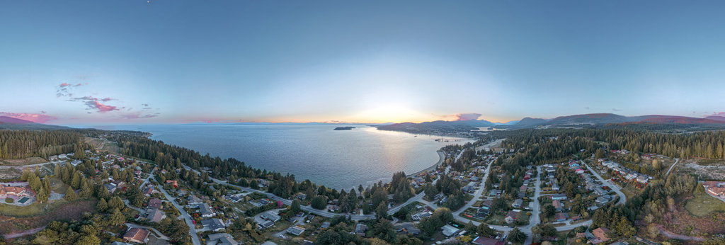
Robert Prior
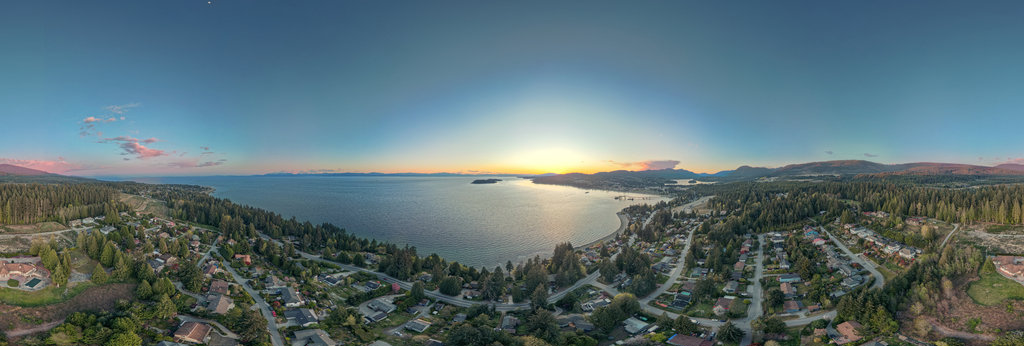
Sundown Over Trail Bay, British Columbia (Arran LUT)
18000 x 9000
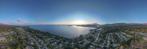
Robert Prior
Sundown Over Trail Bay, British Columbia (Braemar LUT)
18000 x 9000
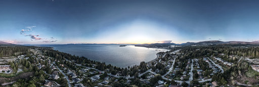
Robert Prior
Sundown Over Trail Bay, British Columbia (Bleach Bypass)
18000 x 9000
Robert Prior
Sundown Over Trail Bay, British Columbia (Mull LUT)
18000 x 9000
Robert Prior
Mission Point Park at Davis Bay, British Columbia
18000 x 9000
Andrew Bodrov
Mars Panorama - Perseverance rover: Martian solar day 0670
30000 x 15000
Franck Masschelein
Fort Maulde (#4) - Inner courtyard
10656 x 5328
Franck Masschelein
Fort Maulde (#5) - A19 observatory block - the GFM cloches
10668 x 5334
William L
McConnell Lake
20756 x 10378
Robert Prior
New Construction in Selma Park
18000 x 9000
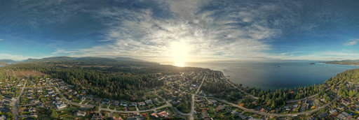
Robert Prior
Aerial View of Gibsons from Armours Beach (I)
18000 x 9000
William L
Skeena/Kispiox River confluence
20756 x 10378
Robert Prior
Aerial View of Gibsons from Armours Beach (I) (Arran LUT)
18000 x 9000
Robert Prior
Aerial View of Gibsons from Armours Beach (III)
18000 x 9000
Robert Prior
Aerial View of Gibsons from Armours Beach (I) (Braemar LUT)
18000 x 9000
Robert Prior
Aerial View of Gibsons from Armours Beach (III) (Arran LUT)
18000 x 9000
Robert Prior
Aerial View of Davis Bay from Laurel Avenue
18000 x 9000
Robert Prior
New Construction in Selma Park (Arran LUT)
18000 x 9000
Robert Prior
Aerial View of Davis Bay from Laurel Avenue (Arran LUT)
18000 x 9000
Robert Prior
Aerial View of Davis Bay from Laurel Avenue (Braemar LUT)
18000 x 9000
Robert Prior
Aerial View of Gibsons from Armours Beach (III) (Braemar LUT)
18000 x 9000
Robert Prior
Aerial View of Davis Bay from Laurel Avenue (Mull LUT)
18000 x 9000
Robert Prior
Aerial View of Davis Bay from Laurel Avenue (Bleach Bypass)
18000 x 9000
William L
Mosquito Lake
13200 x 6600
← Previous
-
1
-
2
-
…
-
20
-
21
-
22
-
23
-
24
-
25
-
26
-
27
-
28
-
…
-
119
-
120
-
Next →
Cookies help us deliver great service to you. By using this site, you agree to the use of cookies.
OK
Leave this Site