Toggle navigation
Search
Search
登陆 / 注册
登陆
New Account / View Pricing
浏览
360° Video Gallery
世界地图
编辑之选
千兆像素全景
360° Stereoscopic Panoramas
Learn
CONTRIBUTE
LICENSE
EARN $ FROM YOUR WORK
FREE RESEARCH
浏览
360° Video Gallery
Gigapixel Gallery
Curated Sets
世界地图
360° Stereoscopic
精品
More
Learn
CONTRIBUTE
LICENSE
EARN $ FROM YOUR WORK
FREE RESEARCH
注册/登陆
登陆
Get a new Contributor Account
Get a new Licensing Customer Account
Newsletter
×
Lightboxes
Copy
Create New Lightbox
This Lightbox is empty
×
Saved!
Search Results for @tags ester mountains
Keywords
Location
Contributor
Show only licensable content
Show live previews
Search
Keyword Tip: Use quotation marks ("Golden Gate Bridge") to search for an exact phrase.
More tips
.
全景 (+10000)
Videos (444)
Contributors (1)
William L
Bernard Lake
20756 x 10378
William L
Middle Palisade - lower gendarme
20756 x 10378
William L
Stoney Ridge inversion, Trinity Alps, CA, USA (aerial)
18800 x 9400
William L
Upper/Lower Marilyn Lakes (aerial)
18800 x 9400
William L
Klondike Highway - Tintina Trench (aerial)
18800 x 9400
William L
Highway 230 - Foster Creek intersection (aerial)
18800 x 9400
Bill Edwards
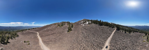
Goat Peak, Larch Vista, Okanogan-Wenatchee National Forest, WA State
16442 x 8221
Bill Edwards
Goat Peak, Ridgecrest Vista, Okanogan-Wenatchee National Forest, WA State
16452 x 8226
Bill Edwards
Goat Peak, Silent Sentinels, Okanogan-Wenatchee National Forest, WA State
16436 x 8218
William L
Bentonite Hills - Purple Mountain (aerial)[2]
18800 x 9400
William L
Appa Glacier erratic
20756 x 10378
William L
Canton Point (4842'/1476m) summit (aerial)
20756 x 10378
William L
Burney Mountain Road (aerial)
18800 x 9400
Bill Edwards
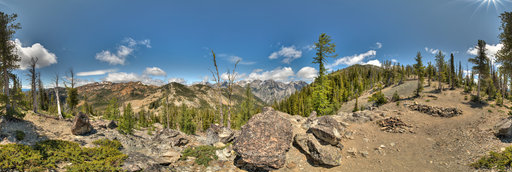
Stuart Range, Navaho Peak Trail, Okanagan Wenatchee National Forest, WA
16450 x 8225
Denys Ovchar
Захід сонця на полонині Середня
6000 x 3000
William L
Bula Mine [2]
20756 x 10378
William L
Trail Gulch pass
13200 x 6600
William L
Wards Fork Gap (aerial)
18800 x 9400
William L
Chetco Lake [1]
20756 x 10378
William L
Chetco Lake [2]
12804 x 6402
William L
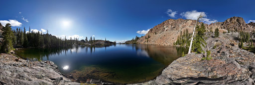
South Sugar Lake [1]
20756 x 10378
William L
Aspen Lake [2]
20756 x 10378
William L
Billys Peak BM (7275'/2217m) summit (gigapixel)
54888 x 27444
Dashkov Vladimir
Animal Caucasus Mountains
3590 x 1795
← Previous
-
1
-
2
-
…
-
77
-
78
-
79
-
80
-
81
-
82
-
83
-
84
-
85
-
…
-
416
-
417
-
Next →
Cookies help us deliver great service to you. By using this site, you agree to the use of cookies.
OK
Leave this Site