Open Map
Close Map
N
Projektioner och Nav lägen
  • Normal View
  • Fisheye View
  • Architectural View
  • Stereographic View
  • Little Planet View
  • Panini View
Click and Drag / QTVR mode
Dela detta panorama
För icke-kommersiellt bruk
Detta panorama kan bäddas in på en icke-kommersiell webbplats utan kostnad. Läs mera
Vill du gå med på Terms & Conditions?
För kommersiellt bruk, kontakta oss
Bädda in detta panorama
BreddHöjd
För icke-kommersiellt bruk
För kommersiellt bruk, kontakta oss
LICENSIERA MODAL

0 Likes

Langmannweg (1950 m)
Austria
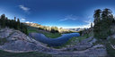
The Langmannweg is a hiking path in the Rottenmanner Tauern mountain range in Styria, Austria. The photo was taken at an alitude of ~1950 m, overlooking the two Scheiblsee lakes. The path leads up to the Großer Hengst mountain (2159 m) and continues to the Großer Bösenstein (2448 m).

Copyright: Herbert Raab
Typ: Spherical
Upplösning: 17232x8616
Taken: 22/06/2026
Uppladdad: 10/07/2026
Published: 10/07/2026
Visningar:

...


Tags: outdoors; outside; mountain; hike; trekking; summer
Mer om Austria


It looks like you’re creating an order.
If you have any questions before you checkout, just let us know at [email protected] and we’ll get right back to you.