Toggle navigation
Search
Search
ログイン / 参加
ログイン
New Account / View Pricing
さらなる探求
360° Video Gallery
世界地図
編集者のお勧め
ギガピクセル
360° Stereoscopic Panoramas
Learn
CONTRIBUTE
LICENSE
EARN $ FROM YOUR WORK
FREE RESEARCH
さらなる探求
360° Video Gallery
Gigapixel Gallery
Curated Sets
世界地図
360° Stereoscopic
編集者のおすすめ
More
Learn
CONTRIBUTE
LICENSE
EARN $ FROM YOUR WORK
FREE RESEARCH
参加/ログイン
ログイン
Get a new Contributor Account
Get a new Licensing Customer Account
Newsletter
×
Lightboxes
Copy
Create New Lightbox
This Lightbox is empty
×
Saved!
Search Results for @tags eureka valley
Keywords
Location
Contributor
Show only licensable content
Show live previews
Search
Keyword Tip: Use quotation marks ("Golden Gate Bridge") to search for an exact phrase.
More tips
.
パノラマ (9966)
Videos (385)
Contributors (1)
William L
Diamond Tunnel - residence (ruins)[1]
13200 x 6600
William L
Diamond Tunnel - residence (ruins)[2]
13200 x 6600
William L
Diamond Tunnel tailings
13200 x 6600
Brian L Richards
Norman Castle, Gerace, Calabria, Italy
16384 x 8192
Auggie Werner
In the Jura Mountains near Biel Bienne
17896 x 8948
Isabel Marques
Saas Grund Cemetery and Saint's Chapel
6000 x 3000
Isabel Marques
Saas Grund Hohsaas 1
6000 x 3000
Isabel Marques
Saas-Grund - Hohsaas 2
6000 x 3000
Isabel Marques
Saas Grund-Saastalstrasse 1
6000 x 3000
Isabel Marques
Saas Grund-Saastalstrasse 2
6000 x 3000
Isabel Marques
Saas Grund - Tamatten
6000 x 3000
William L
'Lady in the Fridge' crime scene
12804 x 6402
Raynor Garey
Above the desert valley near Henderson, NV
8192 x 4096
andynewmanimages
Moors Valley Country Park and Railway in Dorset, united Kingdom
6000 x 3000
Gil Abadines
The Jamison Valley as viewed from Queen Elizabeth Lookout, Katoomba
14000 x 7000
Wayne Drzewiecki
Scenic Valley views on a cloudy day, Abercrombie National Park
24958 x 12479
Auggie Werner
Intersection of Lawrence Avenue East and Don Valley Parkway, Toronto
17908 x 8954
Auggie Werner
Bright Spring Afternoon at Toronto's Don Valley (Aerial Drone View)
17996 x 8998
Ignacio Borrego Polanco
Saint Gil Hermitage, Nuria Virgin Sanctuary, Nuria Valley, Catalonia, Spain
8000 x 4000
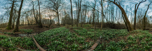
Jindrich Cermak
In a creek valley with so called spring snowflake flowers
11904 x 5952
William L
Donner Camp [2]
20756 x 10378
William L
Highway 97/A12 intersection (aerial)
18800 x 9400
William L
Sad Boulders [2]
13200 x 6600
Jose Ignacio Teran
Aerial panorama with my drone in Pinera de arriba 2 in Ubina-La Mesa Natural Park
12000 x 6000
← Previous
-
1
-
2
-
…
-
25
-
26
-
27
-
28
-
29
-
30
-
31
-
32
-
33
-
…
-
382
-
383
-
Next →
Cookies help us deliver great service to you. By using this site, you agree to the use of cookies.
OK
Leave this Site